Williamsburg, Colorado
Appearance
Williamsburg, Colorado | |
|---|---|
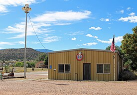
 The town hall on John Street, September 2018 | |
 Location of Williamsburg in Fremont County, Colorado. | |
| Coordinates: 38°23′1″N 105°9′37″W / 38.38361°N 105.16028°W | |
| Country | |
| State | |
| County[1] | Fremont County |
| Incorporated | April 7, 1888[2] |
| Government | |
| • Type | Statutory Town[1] |
| Area | |
| • Total | 3.53 sq mi (9.15 km2) |
| • Land | 3.53 sq mi (9.15 km2) |
| • Water | 0.00 sq mi (0.00 km2) |
| Elevation | 5,390 ft (1,643 m) |
| Population | |
| • Total | 731 |
| • Density | 210/sq mi (80/km2) |
| Time zone | UTC-7 (Mountain (MST)) |
| • Summer (DST) | UTC-6 (MDT) |
| ZIP code[6] | 81226 |
| Area code | 719 |
| FIPS code | 08-85155 |
| GNIS feature ID | 0203567 |
| Website | williamsburgcolorado |
Williamsburg is a statutory town located in Fremont County, Colorado, United States. The town population was 731 at the 2020 census.[5] The Florence post office (ZIP code 81226) serves Williamsburg.[6]
History
[edit]Geography
[edit]Williamsburg is located in southeastern Fremont County at 38°23′1″N 105°9′37″W / 38.38361°N 105.16028°W (38.383623, -105.160337).[7] It is bordered to the east by the city of Florence and to the south by the town of Rockvale. Cañon City, the county seat, is 8 miles (13 km) to the northwest.
According to the United States Census Bureau, Williamsburg has a total area of 3.6 square miles (9.2 km2), all of it land.[8]
Demographics
[edit]| Census | Pop. | Note | %± |
|---|---|---|---|
| 1900 | 337 | — | |
| 1910 | 556 | 65.0% | |
| 1920 | 402 | −27.7% | |
| 1930 | 155 | −61.4% | |
| 1940 | 97 | −37.4% | |
| 1950 | 65 | −33.0% | |
| 1960 | 57 | −12.3% | |
| 1970 | 75 | 31.6% | |
| 1980 | 72 | −4.0% | |
| 1990 | 253 | 251.4% | |
| 2000 | 714 | 182.2% | |
| 2010 | 662 | −7.3% | |
| 2020 | 731 | 10.4% | |
| U.S. Decennial Census | |||
See also
[edit]References
[edit]- ^ a b "Active Colorado Municipalities". State of Colorado, Department of Local Affairs. Archived from the original on December 12, 2009. Retrieved September 1, 2007.
- ^ "Colorado Municipal Incorporations". State of Colorado, Department of Personnel & Administration, Colorado State Archives. December 1, 2004. Retrieved September 2, 2007.
- ^ "2019 U.S. Gazetteer Files". United States Census Bureau. Retrieved July 1, 2020.
- ^ "US Board on Geographic Names". United States Geological Survey. October 25, 2007. Retrieved January 31, 2008.
- ^ a b United States Census Bureau. "Williamsburg town; Colorado". Retrieved April 24, 2023.
- ^ a b "ZIP Code Lookup" (JavaScript/HTML). United States Postal Service. December 14, 2006. Retrieved December 14, 2006.
- ^ "US Gazetteer files: 2010, 2000, and 1990". United States Census Bureau. February 12, 2011. Retrieved April 23, 2011.
- ^ "Geographic Identifiers: 2010 Census Summary File 1 (G001): Williamsburg town, Colorado". American Factfinder. U.S. Census Bureau. Archived from the original on February 13, 2020. Retrieved April 21, 2016.
External links
[edit]Wikimedia Commons has media related to Williamsburg, Colorado.

